Main Content


Central America
::
Navassa Island
Print
Page last updated on December 18, 2019
The World Factbook
Country/Location Flag Modal
Central America ::
Navassa Island
Print
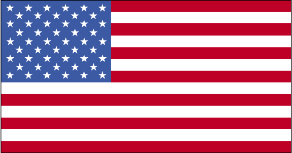
Flag Description
the flag of the US is used
The World Factbook
Country/Location Locator Map Modal
Central America ::
Navassa Island
Print
The World Factbook
Country/Location Photo Gallery Modal
Central America ::
Navassa Island

1 /
1
Caption
Astronaut photo of teardrop-shaped Navassa Island. The island is basically a plateau encircled by fairly steep cliffs. Image courtesy of NASA.
Dimensions
File Size
Download
Usage
Factbook photos - obtained from a variety of sources - are in the public domain
and are copyright free.
Agency Copyright Notice
Agency Copyright Notice
-
Introduction :: Navassa Island
-
 This uninhabited island was claimed by the US in 1857 for its guano. Mining took place between 1865 and 1898. The lighthouse, built in 1917, was shut down in 1996 and administration of Navassa Island transferred from the US Coast Guard to the Department of the Interior, Office of Insular Affairs. A 1998 scientific expedition to the island described it as a "unique preserve of Caribbean biodiversity." The following year it became a National Wildlife Refuge and annual scientific expeditions have continued.
 -
Geography :: Navassa Island
-
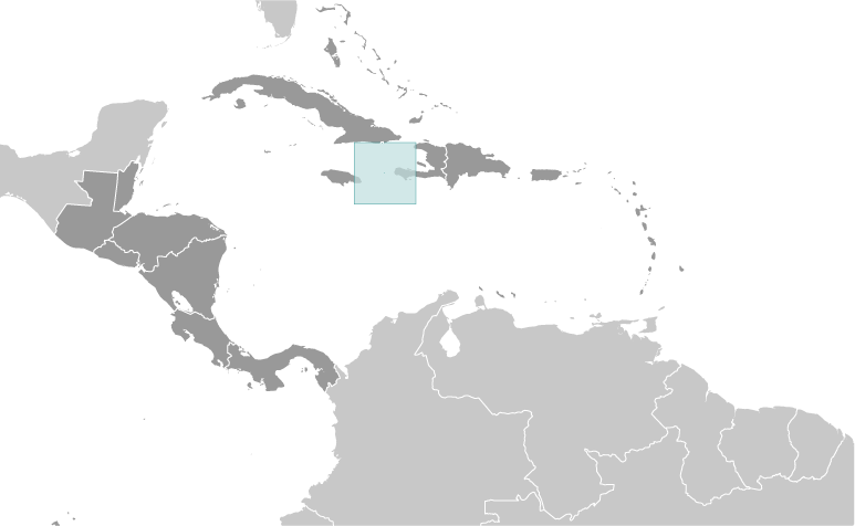
Caribbean, island in the Caribbean Sea, 30 nm west of Tiburon Peninsula of Haiti
18 25 N, 75 02 W
Central America and the Caribbean
about nine times the size of the National Mall in Washington, DC
0 km
8 km
territorial sea: 12 nmexclusive economic zone: 200 nm
marine, tropical
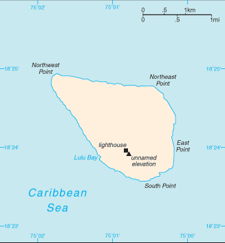
raised flat to undulating coral and limestone plateau; ringed by vertical white cliffs (9 to 15 m high)
lowest point: Caribbean Sea 0 mhighest point: 200 m NNW of lighthouse 85 m
guano (mining discontinued in 1898)
agricultural land: 0% (2011 est.)arable land: 0% (2011 est.) / permanent crops: 0% (2011 est.) / permanent pasture: 0% (2011 est.)forest: 0% (2011 est.)other: 100% (2011 est.)
hurricanes
some coral bleaching
strategic location 160 km south of the US Naval Base at Guantanamo Bay, Cuba; mostly exposed rock with numerous solution holes (limestone sinkholes) but with enough grassland to support goat herds; dense stands of fig trees, scattered cactus
-
People and Society :: Navassa Island
-
uninhabited; transient Haitian fishermen and others camp on the island
NA
-
Government :: Navassa Island
-
conventional long form: noneconventional short form: Navassa Islandetymology: the flat island was named "Navaza" by some of Christopher COLUMBUS' sailors in 1504; the name derives from the Spanish term "nava" meaning "flat land, plain, or field"
unorganized, unincorporated territory of the US; administered by the Fish and Wildlife Service, US Department of the Interior from the Caribbean Islands National Wildlife Refuge in Boqueron, Puerto Rico; in September 1996, the Coast Guard ceased operations and maintenance of the Navassa Island Light, a 46-meter-tall lighthouse on the southern side of the island; Haiti has claimed the island since the 19th century
the laws of the US apply where applicable
none (territory of the US)
the flag of the US is used
-
Economy :: Navassa Island
-
Subsistence fishing and commercial trawling occur within refuge waters.
-
Military and Security :: Navassa Island
-
defense is the responsibility of the US
-
Transportation :: Navassa Island
-
none; offshore anchorage only
-
Transnational Issues :: Navassa Island
-
claimed by Haiti, source of subsistence fishing