Main Content


Antarctica
::
Heard Island and McDonald Islands
Print
Page last updated on December 18, 2019
The World Factbook
Country/Location Flag Modal
Antarctica ::
Heard Island and McDonald Islands
Print
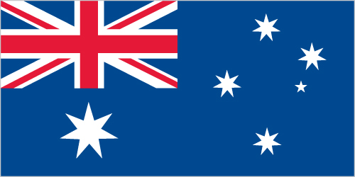
Flag Description
the flag of Australia is used
The World Factbook
Country/Location Locator Map Modal
Antarctica ::
Heard Island and McDonald Islands
Print

The World Factbook
Country/Location Photo Gallery Modal
Antarctica ::
Heard Island and McDonald Islands


1 /
2
Caption
The northeastern slopes of Big Ben volcano on Heard Island are visible in shadow at the top right of this photo. Mawson Peak (small circle in the upper center of the image), sits within a breached caldera (collapsed and empty magma chamber beneath a volcano) on the southwestern side of the volcano - the shadow cast by Mawson Peak points directly to the crescent-shaped caldera rim. This image, taken during the Southern Hemisphere summer, also shows the dark brown volcanic rock that forms the island. The southwest-pointing tongue of ice is Gotley Glacier. Image credit: NASA.
Dimensions
File Size
Download
Usage
Factbook photos - obtained from a variety of sources - are in the public domain
and are copyright free.
Agency Copyright Notice
Agency Copyright Notice

2 /
2
Caption
In October 2012, satellites measured subtle signals that suggested volcanic activity on remote Heard Island. These images, captured several months later, show proof of an eruption on Mawson Peak. By early April 2013, Mawson's steep-walled summit crater had filled, and a trickle of lava had spilled down the volcano's southwestern flank. Image courtesy of NASA.
Dimensions
File Size
Download
Usage
Factbook photos - obtained from a variety of sources - are in the public domain
and are copyright free.
Agency Copyright Notice
Agency Copyright Notice
-
Introduction :: Heard Island and McDonald Islands
-
 The UK transferred these uninhabited, barren, sub-Antarctic islands to Australia in 1947. Populated by large numbers of seal and bird species, the islands have been designated a nature preserve.
 -
Geography :: Heard Island and McDonald Islands
-
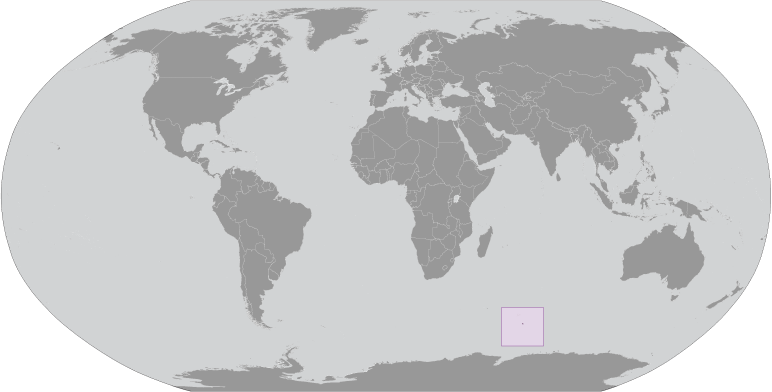
islands in the Indian Ocean, about two-thirds of the way from Madagascar to Antarctica
53 06 S, 72 31 E
Antarctic Region
slightly more than two times the size of Washington, DC
0 km
101.9 km
territorial sea: 12 nmexclusive fishing zone: 200 nm
antarctic
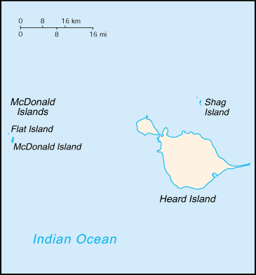
Heard Island - 80% ice-covered, bleak and mountainous, dominated by a large massif (Big Ben) and an active volcano (Mawson Peak); McDonald Islands - small and rocky
lowest point: Indian Ocean 0 mhighest point: Mawson Peak on Big Ben volcano 2,745 m
fish
agricultural land: 0% (2011 est.)arable land: 0% (2011 est.) / permanent crops: 0% (2011 est.) / permanent pasture: 0% (2011 est.)forest: 0% (2011 est.)other: 100% (2011 est.)
Mawson Peak, an active volcano, is on Heard Island
none; uninhabited and mostly ice covered
Mawson Peak on Heard Island is the highest Australian mountain (at 2,745 meters, it is taller than Mt. Kosciuszko in Australia proper), and one of only two active volcanoes located in Australian territory, the other being McDonald Island; in 1992, McDonald Island broke its dormancy and began erupting; it has erupted several times since, most recently in 2005
-
People and Society :: Heard Island and McDonald Islands
-
uninhabited
-
Government :: Heard Island and McDonald Islands
-
conventional long form: Territory of Heard Island and McDonald Islandsconventional short form: Heard Island and McDonald Islandsabbreviation: HIMIetymology: named after American Captain John HEARD, who sighted the island on 25 November 1853, and American Captain William McDONALD, who discovered the islands on 4 January 1854
territory of Australia; administered from Canberra by the Department of Sustainability, Environment, Water, Population and Communities (Australian Antarctic Division)
the laws of Australia apply where applicable
none (territory of Australia)
none (territory of Australia)
the flag of Australia is used
-
Economy :: Heard Island and McDonald Islands
-
The islands have no indigenous economic activity, but the Australian Government allows limited fishing in the surrounding waters. Visits to Heard Island typically focus on terrestrial and marine research and infrequent private expeditions.
-
Communications :: Heard Island and McDonald Islands
-
.hm
-
Military and Security :: Heard Island and McDonald Islands
-
defense is the responsibility of Australia; Australia conducts fisheries patrols
-
Transportation :: Heard Island and McDonald Islands
-
none; offshore anchorage only
-
Transnational Issues :: Heard Island and McDonald Islands
-
none