Main Content


Australia - Oceania
::
Kingman Reef
Print
Page last updated on December 06, 2019
The World Factbook
Country/Location Flag Modal
Australia - Oceania ::
Kingman Reef
Print
Flag Description
the flag of the US is used
The World Factbook
Country/Location Locator Map Modal
Australia - Oceania ::
Kingman Reef
Print

The World Factbook
Country/Location Photo Gallery Modal
Australia - Oceania ::
Kingman Reef


1 /
2
Caption
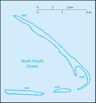
Satellite view of Kingman Reef reveals that it is triangular in shape and largely submerged; only the eastern third or so emerges at high tide. The reef's sheltered lagoon and surrounding waters support a diverse marine fauna. Image courtesy of NASA.
Dimensions
File Size
Download
Usage
Factbook photos - obtained from a variety of sources - are in the public domain
and are copyright free.
Agency Copyright Notice
Agency Copyright Notice

2 /
2
Caption
Aerial view of Kingman Reef from the southeast. Photo courtesy of Susan White/US Fish and Wildlife Service.
Dimensions
File Size
Download
Usage
Factbook photos - obtained from a variety of sources - are in the public domain
and are copyright free.
Agency Copyright Notice
Agency Copyright Notice
-
Introduction :: Kingman Reef
-
 The US annexed the reef in 1922. Its sheltered lagoon served as a way station for flying boats on Hawaii-to-American Samoa flights during the late 1930s. There are no terrestrial plants on the reef, which is frequently awash, but it does support abundant and diverse marine fauna and flora. In 2001, the waters surrounding the reef out to 12 nm were designated a US National Wildlife Refuge.
 -
Geography :: Kingman Reef
-
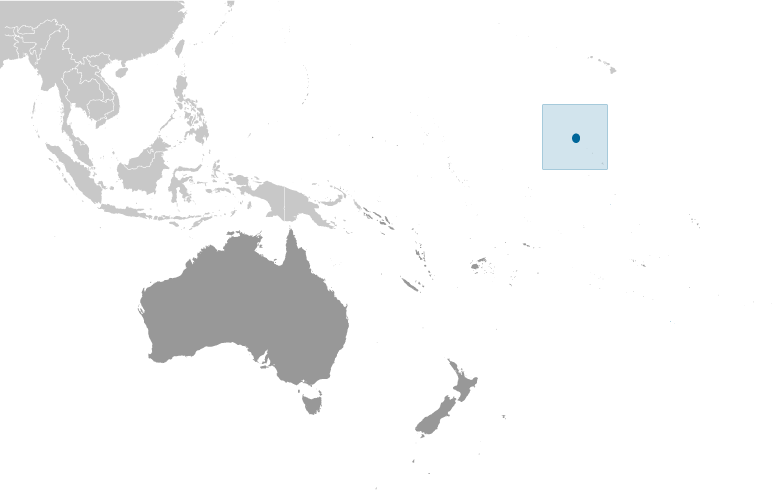
Oceania, reef in the North Pacific Ocean, about half way between Hawaii and American Samoa
6 24 N, 162 22 W
Oceania
about 1.7 times the size of The Mall in Washington, DC
0 km
3 km
territorial sea: 12 nmexclusive economic zone: 200 nm
tropical; moderated by prevailing winds
low and nearly level
terrestrial and aquatic wildlife
wet or awash most of the time, maximum elevation of about 1 meter makes Kingman Reef a maritime hazard
illegal foreign fishing; marine debris washing up on reef can entangle and kill wildlife
barren coral atoll with deep interior lagoon; closed to the public
-
People and Society :: Kingman Reef
-
uninhabited
-
Government :: Kingman Reef
-
conventional long form: noneconventional short form: Kingman Reefetymology: although discovered in 1798, the reef is named after Captain W. E. KINGMAN who described it in 1853
unincorporated territory of the US; administered from Washington, DC, by the US Fish and Wildlife Service of the Department of the Interior
note: on 1 September 2000, the Department of the Interior accepted restoration of its administrative jurisdiction over Kingman Reef from the Department of the Navy; Executive Order 3223 signed 18 January 2001 established Kingman Reef National Wildlife Refuge to be administered by the Director, US Fish and Wildlife Service; this refuge is managed to protect the terrestrial and aquatic wildlife of Kingman Reef out to the 12 nm territorial sea limit
the laws of the US apply where applicable
the flag of the US is used -
Military and Security :: Kingman Reef
-
defense is the responsibility of the US
-
Transportation :: Kingman Reef
-
none; offshore anchorage only
-
Transnational Issues :: Kingman Reef
-
none